Saturday, August 31, 2013

Day 10 - Beartooth and Chief Joseph Scenic Byways Part 2


As I left off in Part 1 of this series we were traveling through the Lamar Valley and now entering into the Northeast corner of YNP. The scenic beauty of this part of the Park has it's own personality. It's really fun to venture out into different parts because there is just so much to see. 


Lamar River looking South West

Lamar River looking North East

After getting tired of these ugly views we drove out for the NE Park entrance and entered into the Beartooth Scenic Byway (Gallatin National Forest) (aka Beartooth All-American Road)


and Silver Gate, Montana, population of 170. As the name implies this was a booming silver mining town once upon a time. Some of the old mining town buildings are still standing, some restored, some in shambles, others, like pictured below, look like they came off an old Hollywood movie lot. 


It was still a nice place to visit and wander around the gift shops.

We were not in Montana very long, but we will visit this state once again by mistake. I will cover that later. 

Our next side tour was to drive up a winding rock road to the Clay Butte Fire Tower. Unfortunately about 3/4 of the way up the Shoshone National Forest Rangers had the road closed off for reasons unknown to us. However, the view from where we turned around was spectacular and I could not resist the following photos of the wild flowers with Beartooth mountains (also looking into Montana) in the background; Cindy posing in a field of more wild flowers; and finally a shot of the Clay Butte Fire Tower that we never got too. :(


Wild Flowers captured by Cindy on a side trail that she wondered off on. She did that a lot on this trip! :)


Cindy among the wild flowers in the Clay Butte area of Wyoming. Very stylish in her cool breeze glasses!

Clay Butte Fire Tower. The road was closed off to the public.

Just past the junction for the Chief Joseph Scenic Byway (we will return to this road) we came upon a very nice waterfall called Lake Creek Falls. The sunlight was perfect for a couple shots including one that I really like of Cindy.


Lake Creek looking south from the falls

Lake Creek Falls, Wyoming along the Beartooth Highway

Cindy at Lake Creek Falls, Wyoming


As the Beartooth highway continues we find more and more side roads to pull off on. Now you can see why they call this a scenic byway. The next picture was taken from the Beartooth Lake Campground of the named lake and Beartooth Butte.


Now the road winds its way up towards Beartooth Pass. 


This where a few interesting things start happening. A cold front from the Northwest is moving in along with a rain shower, which started at around the 10,000 feet level, which then turned to pea size hail at the top of the mountain. The top of the mountain is a 10,947 feet. This is the highest point we got too during the entire Wyoming adventure. It was really starting to get dicey (yet very cool) up here with the wind and clouds rolling over the top. One would think that the state of Wyoming would place a nice sign at the top to let visitors know that they had in fact made it to the top of Beartooth Pass. Since this was toted as the pinnacle of the scenic drive. But NOOOOOOO sign to be found. We kept driving and low and behold we find these signs.


This is typical of our adventures. If we don't have to make one or more U-turns it would not be worth writing about!

So back into Wyoming we go and back into the hail that we left behind at the "real" top of the mountain. The views in between rain showers was nice. Cindy braved most of the following shots. I admit I stayed in the warm car!


A captured shot of my GPS at the top of Beartooth Pass. Please note that the total trip was approximately 250 miles so we still have close to 78 miles to go. We are also 8 plus hours into the trip since leaving the Trail Shop Inn.

Here is Cindy up on Beartooth Pass at over 10,900 feet. Notice the wind blow hair and fleece. It was cold and wet.


No that is not a smudge on the camera lens, that is hail! But still a nice photo to include wild flowers in the foreground.


Wild Flowers at 10,900 feet on Beartooth Pass, Wyoming


Yes that is Chris sitting in the warm car with fleece on and asking Cindy to take a picture of the pea size hail. WHAT A GUY!


We are finally back off the mountain and returned to the Chief Joseph Scenic Highway. I will leave that to Part 3 of this journey. We hope you like it so far!


Thursday, August 29, 2013

Day 10 - Beartooth and Chief Joseph Scenic Byways Part 1

Just the post title alone intrigues me to want to read further! There is some much to talk about and pictures to prepare I have to break this up into parts. 

Today was one of our highlights of the adventure. Cindy really did her homework and earned her A+ from the Master's class in logistics that I eluded to in an earlier post. This 245 mile loop road trip was one of the most scenic and very open (much above treeline) road trips that we have done together. 

All of this started with an alarm clock going off at 5:30 a.m. That's right we were on vacation and getting up before the sunrise. But it was something we had to do in order to travel almost 250 miles to ensure that see what was on on our itinerary. We left Wapiti and the Trail Shop Inn and made our way back to the east entrance to YNP. Our first stop was in the Lake Village and Bridge Bay area (headwaters of the Yellowstone River)


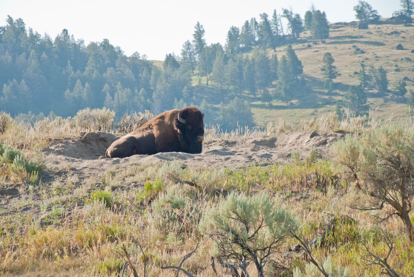
for breakfast before heading in the Hayden Valley. Our expectation of seeing wildlife was granted very early, yet somewhat unexpected as it was very foggy following the Yellowstone River (see photo above) that early in the morning. As it turned out there was a herd of Bison walking along the road or plopping down in any available dust bowls. Here are a couple of the big fellows who could honestly careless that we were there!


We drove past Canyon Village (lots more to come from there) and up and over Dunraven Pass at 8,859 feet. This area will come back into the discussion during our hike up Mount Washburn. Here is a view from one of the many turnouts with some back country geysers that are all over the Park.


Further up the road we got to the Tower-Roosevelt junction. We took a small detour into the Roosevelt Lodge, but were not impressed, so we moved into the next well known wildlife areas called the Lamar Valley.

Lamar Valley, Yellowstone National Park


This VERY LARGE and open valley is teaming with Bison, Antelope, and birds of prey. The picture above does not do justice for the thousands of Bison that were  grazing in this area. I'm sure you have figured out by now that you can click on each picture to expand them to full size. In this photo you can see all the black dots --those are all Bison way off by the Lamar River that flows down through this valley. This went on for miles. Many wildlife photographers with there very expensive telescopic lenses and spotting scopes were posted along every turnout -- not for the Bison, but looking for Wolves and Grizzlies. Unfortunately, we did not see any, but these enthusiasts will sit there for hours waiting for maybe a 30 second glimpse of a Wolf. Some people, including us would say --a bad day of not seeing a wolf or grizzly in Yellowstone National Park is much better than a good day at work! -- 

Stay tuned for Part 2 as we drive along the Beartooth Scenic Byway and on our way into Montana.


Sunday, August 25, 2013

Day 9 - Old Faithful and Geyser Basin


Our day 9 adventure brought us back through the east entrance of Yellowstone National Park (YNP) from Wapiti to explore Old Faithful and other geysers in this thermal area. More to follow, but first a short geology lesson:

The geology of Yellowstone is fascinating at so many levels it's not possible to capture this history in a blog. But a couple facts that we picked up on is that many locations around the world like New Zealand and Iceland are well known for their geysers, but nowhere are there as many as in Yellowstone. Additionally, three major volcanic events happened during the history of this area. The first one was 2 million years ago, then 1.3 million years ago, and the last known event was only 640,000 years ago. In geology time that is like a snap of your fingers. This last event spewed over 640 cubic miles of debris and the inward collapse of the volcano formed a 30- by 40-mile caldera. In comparison, the Mount St. Helen's volcano eruption in May, 1980 spewed only 0.67 miles of debris and the caldera left behind was 1.2- by 1.8 miles. It's hard to imagine this type of destruction at the Yellowstone site and knowing that this area is still an active volcano with multiple earthquakes very day that could easily trigger another eruption! 

Over half of the caldera is now filled in by Yellowstone Lake. Active hot spots are still being generated by the magmatic heat from the volcano that erupted 640,000 years ago thus causing today's geysers to erupt with steaming hot gushes of steam and water (like Old Faithful) to simple boiling springs like you will see with pictures of the Grand Prismatic Spring.

Here are a few pictures and videos from the our drive from Wapiti to the Old Faithful area.


Rock formations as seen just east of Wapiti, Wyoming and near the east entrance to Yellowstone National Park


A Raven's fan should always take a photo of their favorite bird, especially when seen in the wild! This guy was posing at one of the scenic turnouts near Yellowstone Lake.

Here is a video taken of Lake Yellowstone from Lake Butte Overlook.


One of many hot springs in the Old Faithful geyser basin


Historic Old Faithful Inn. Notice the burned out trees behind the Inn. This is from a lightning induced fire in 1988 several weeks after we visited the park. The Park boundaries that are in Wyoming, Montana, and Idaho encompass 2.2 million acres. The numerous fires that flared up that summer burned 37 percent of that acreage.  It's hard to imagine how difficult it was for the fire crews to contain this fire so close to a world renowned and historic structure like this Inn.

Old Faithful geyser starting to erupt

About 30 seconds into the eruption

Reaching  full strength

Here is a video clip of Old Faithful erupting!


Steam vents along the Firehole River near the Old Faithful Geyser Basin

The Old Faithful area is one of the most scenic locations in the Park and sought after by visitors from around the world. We were impressed by the traffic control and parking lots, but the hordes of people (okay we were there too) was way too much for us to handle for more than a couple of hours. So we moved on to another area called Grand Prismatic Spring. As we drove into the parking area, the Park Rangers were closing the area down due to safety reasons. We did not hear directly from the Rangers but we expect the wind changed direction and the sulfur smell from the hot spring was blowing directly into the viewing area for the visitors. We looked at a map and saw a trail on the opposite side of the hot spring, so we maneuvered over to another parking area and decided that an unscheduled hike might get us a better look at the spring and one that the Rangers would unlikely close off. Our hunch paid off. Look at the colors of this spring! We don't think we would have gotten a view like this from the deck that you see on the other side of this photo. BONUS!


Grand Prismatic Spring


Thunderstorms were moving into the area from the west so we decided to drive back to Waipti and then another 30 miles to Cody, Wyoming for a look around the town and dinner. Cody is your quinteessential western cowboy town and appeared to be a base camp for many Recreational Vehicles and bikers. Based on the t-shirts and overheard conversations many of the bikers had just gotten into town from a rally in Sturgis, South Dakota and were heading into Yellowstone. There was no lack of RVs and Bikers in Yellowstone!

The biggest attraction in Cody is their Cody Nite Rodeo. Although we did not stay long enough, they showcase this well known Rodeo http://www.codynightrodeo.com/ every night at 8:00 p.m. 


Saturday, August 24, 2013

Day 8 - Travel Day from Goosewing to Wapiti

Saturday, 27 July 2013, was day 8 for our adventure in Wyoming. Unfortunately we had to bid a fond farewell to the Goosewing Ranch. It was a lot of fun with great horseback riding in the Gros Ventre National Forest mountains that surround the ranch, crystal clear waters teaming with cutthroat trout, relaxing atmosphere promoted by the weather, outstanding hospitality of the ranch hands, general manager, and with out a doubt the owner of this magnificent piece of property. We could not have asked for anything better.

We gathered our belongings, stowed them into our rented 2013 Subaru (very nice car) Outback, and headed back down the 17 mile dusty rock road towards the Grand Tetons National Park (GTNP). 

Here is one of many National Forest employees (others were Pronghorns, Trumpeter Swans, and Whitetail Deer) who said goodbye to us.


Bald Eagle about 2 miles from the gate to Goosewing Ranch

The grandeur of the Tetons greeted us as we drove out of the Gros Ventre National Forest. Here is a picture of the Snake River with the backdrop of the Tetons. It's hard to explain but these jagged peaks above 13,000 feet just seem to rise out of know where.


As luck would have it while I was snapping the above photo of Cindy at Oxbow Bend in GTNP a female Elk or possibly Mule Deer decided to swim across the Snake River over my left shoulder. I'm glad I got (1) the picture of Cindy (2) the picture of the Elk/Mule Deer, and (3) the picture of Cindy before the waves from swimming activity disturbed the reflection of the Tetons in this photo.

Possible Elk or Mule Deer swimming across the very deep Snake River in the Grand Tetons National Park

For the time being we left GTNP to our south and made our way into Yellowstone National Park (YNP). We finally made it back to Yellowstone after vowing to do so after traveling through this park 25 years ago with Michelle during our assignment change from Kelly AFB, Texas to Wheeler AFB, Hawaii. Look at the beginning of this blog to see Chris' picture near a similar YNP sign.


Here is one of many waterfalls we saw throughout the park. This is Lewis Falls.


We drove around the West Thumb of Yellowstone Lake, with stops at Grant Village, Bridge Bay, Lake Village, and Fishing Bridge. The Yellowstone River headwaters (flowing due north) are here at Fishing Bridge with the Yellowstone Lake as its source.

Yellowstone Lake with Grand Tetons to the south

What you see here is the caldera leftover from a volcano - now the Yellowstone Lake. It's a very impressive body of water, bigger than you can imagine and freezes over solid every winter.

We continued our journey through the Absaroka mountain range to our south and the Absaroka Wilderness to our north and finally out through the east entrance of YNP. 

One of many alpine lakes along the way and before we left YNP were Sylvan and Eleanor.

Sylvan Lake west of Sylvan Pass at 8,530 feet

Here are a few pictures (more to come) of the very distinctive geography of the high desert of east central Wyoming. This is in the Shoshone National Forest and very near Wapiti where our Trail Shop Motel was located. Wapiti, Wyoming (population of 177) was our base camp for the next three days.